- View more resources from this publisher
 Usborne Publishing
Children's picture atlas
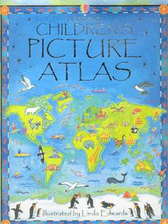
This picture atlas takes young readers on a visual journey around the world, from the hot plains of Africa, to the frozen tundra of the Arctic. Detailed pictorial maps reveal the richness and diversity of human and animal life around the world. Each map shows the countries, their capital cities, most famous landmarks, longest rivers and highest mountains, while picture stories supplement the maps. It provides a simple introduction to maps, world culture and geographical concepts for pre-school children.
Show health and safety information
Please be aware that resources have been published on the website in the form that they were originally supplied. This means that procedures reflect general practice and standards applicable at the time resources were produced and cannot be assumed to be acceptable today. Website users are fully responsible for ensuring that any activity, including practical work, which they carry out is in accordance with current regulations related to health and safety and that an appropriate risk assessment has been carried out.


